|
[English] [Chinese][Dutch][French]
|
|
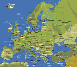
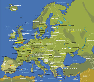
Map of Europe | ||
| Date: | Jan, 2011 (8th Ed) | |||
| Map format: | jpeg | |||
| Dimension: | 920 x 805 pixels (541 kb) | |||
| Copyright holder: | Johomaps! | |||
| Conditions of using this map: | Unlimited educational use, free download. Free web posting with web link to www.johomaps.com | |||
| Computer Specifics: | Prepared using Adobe Illustrator | |||
|
|
||||
|
|
|
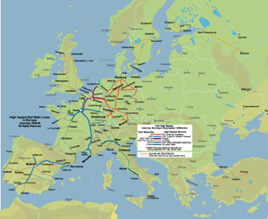
High Speed Rail Map of Europe | ||
| Date: | Nov, 2009 | |||
| Map format: | jpeg | |||
| Dimension: | 1131 x 927 pixels (717 kb) | |||
| Copyright holder: | Johomaps! | |||
| Conditions of using this map: |
All rights reserved.
Contact us at |
|||
| Computer Specifics: | Prepared using Adobe Illustrator | |||
|
|
||||
|
|
|
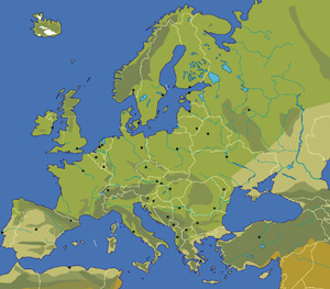
Map of Europe - Blank | ||
| Date: | Jun, 2006 (2nd Ed) | |||
| Map format: | jpeg | |||
| Dimension: | 636 x 629 pixels (370 kb) | |||
| Copyright holder: | Johomaps! | |||
| Conditions of using this map: | Unlimited educational use, free download. Free web posting with web link to www.johomaps.com | |||
| Computer Specifics: | Prepared using Adobe Illustrator | |||
|
|
|
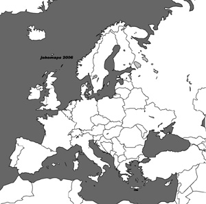
Map of Europe - Blank (Black and White) | ||
| Date: | Jun, 2006 (2nd Ed) | |||
| Map format: | jpeg | |||
| Dimension: | 636 x 629 pixels (99 kb) | |||
| Copyright holder: | Johomaps! | |||
| Conditions of using this map: | Unlimited educational use, free download. Free web posting with web link to www.johomaps.com | |||
| Computer Specifics: | Prepared using Adobe Illustrator | |||
|
|
|
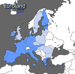
Map of the European Union - EU countries and Euro countries | ||
| Date: | Nov, 2006 (3rd Ed) | |||
| Map format: | jpeg | |||
| Dimension: | 636 x 629 pixels (99 kb) | |||
| Copyright holder: | Johomaps! | |||
| Conditions of using this map: | Unlimited educational use, free download. Free web posting with web link to www.johomaps.com | |||
| Computer Specifics: | Prepared using Adobe Illustrator | |||
|
|
|
Cities in Europe (by Airport traffic) | ||
| Date: | Dec, 2005 (4th Ed) | |||
| Map format: | jpeg | |||
| Dimension: | 920 x 805 pixels (297 kb) | |||
| Copyright holder: | Johomaps! | |||
| Conditions of using this map: | Unlimited educational use, free download. Free web posting with web link to www.johomaps.com | |||
| Computer Specifics: | Prepared using Adobe Illustrator | |||
|
|
|
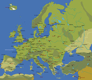
Map of European Cities | ||
| Date: | Nov, 2006 (2nd Ed) | |||
| Map format: | jpeg | |||
| Dimension: | 920 x 805 pixels (573 kb) | |||
| Copyright holder: | Johomaps! | |||
| Conditions of using this map: | Unlimited educational use, free download. Free web posting with web link to www.johomaps.com | |||
| Computer Specifics: | Prepared using Adobe Illustrator | |||
|
|
|
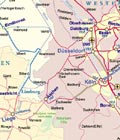
Rail Map of European Continent (NW) | ||
|
|
|
Rail Map of European Continent (SW) | ||