|
|
|
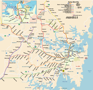
Metro Map of Sydney | ||
| Date: | Mar, 2010 (2nd Ed) | |||
| Map format: | jpeg | |||
| Dimension: | 920 x 885 pixels | |||
| Copyright holder: | Johomaps | |||
| Conditions of using this map: |
All rights reserved.
Contact
|
|||
|
|
||||
|
|
|
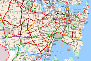
Highway Atlas of Sydney (6 maps) | ||
| Date: | 2006 | |||
| Map format: | jpeg | |||
| Dimension: | various | |||
| Copyright holder: | Bernard Ng | |||
| Conditions of using this map: |
All rights reserved.
Contact
|
|||
|
|
|
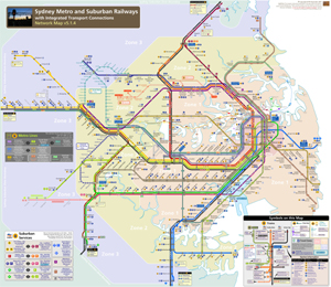
Planned Metro Map of Sydney | ||
| Date: | 2006 | |||
| Map format: | jpeg | |||
| Dimension: | 3117 x 2759 pixels | |||
| Copyright holder: | Bernard Ng | |||
| Conditions of using this map: |
All rights reserved.
Contact
|
|||
|
|
|
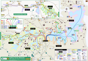
Ferry Map of Sydney | ||
| Date: | 2006 | |||
| Map format: | jpeg | |||
| Dimension: | 2439 x 1701 pixels | |||
| Copyright holder: | Bernard Ng | |||
| Conditions of using this map: |
All rights reserved.
Contact
|
|||
|
Real Time Sydney Travel Info |
||
|
Weather Now |
||
