|
|
||||
|
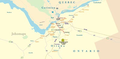
Ottawa is the capital of Canada, and the fourth largest city in the country. The city stands on the south bank of the Ottawa River in the eastern portion of Southern Ontario. Ottawa borders Gatineau, Quebec, and together they form the National Capital Region (NCR). Founded in 1826 as Bytown and incorporated as "Ottawa" in 1855, the city has evolved into a political and technological centre of Canada. Its original boundaries were expanded through numerous minor annexations and ultimately replaced by a new city incorporation and major amalgamation in 2001 which significantly increased its land area. The name "Ottawa" is derived from the Algonquin word adawe, meaning "to trade". Initially an Irish and French Christian settlement, Ottawa has become a multicultural city with a diverse population. The 2011 census had the city's population as 883,391, the census metropolitan area (CMA) population as 1,236,324. Mercer ranks Ottawa with the second highest quality of living of any large city in the Americas, and 14th highest in the world. It is also rated the second cleanest city in Canada, and third cleanest city in the world. In 2012, the city was ranked for the third consecutive year as the best community in Canada to live in by MoneySense.
|
||||