Rail
Map of Europe for Denmark
Rail
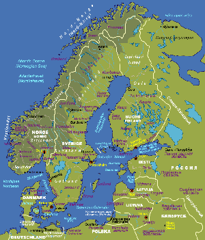
Map of Finland, Norway, and Sweden
by Raileurope.com |
General
Rating:    |
Click view map button
- All major cities within the country
displayed. Railways are displayed in classes: high speed rail
and ordinary railways.
- Click on a list of major cities on the left
column to find it's location
- Hard to find international train routes
since info is truncated at international boundaries.
- Click on the list of countries on the right
column to view a different country.
- Put mouse over the legend to find out routes
served by various high speed rail services.
- User-friendliness: 3.5/5
- Printer-friendliness: 3/5
|
Required
Program |
No |
| Orthophoto |
 |
| Road names and
highway numbers |
|
| Additional Info |
Major stations
and railway routes, country by country |