|
|
||
|
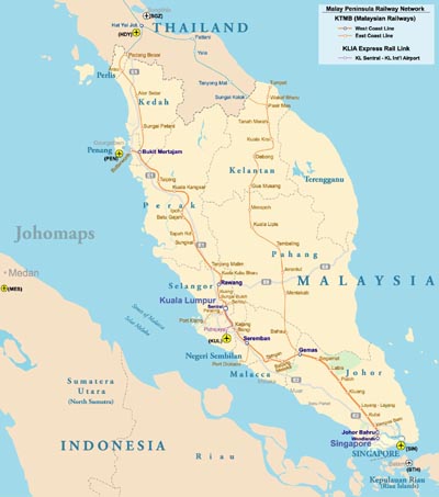
The Malay Peninsula (Malay: Semenanjung Tanah Melayu, Thai: คาบสมุทรมลายู) is a peninsula in Southeast Asia. The land mass runs approximately north-south and, at its terminus, is the southernmost point of the Asian mainland. The area contains the southernmost tip of Myanmar, Peninsular Malaysia, and Southern Thailand. The Titiwangsa Mountains are part of the Tenasserim Hills system, and form the backbone of the Peninsula. They form the southernmost section of the central cordillera which runs from Tibet through the Kra Isthmus (the Peninsula's narrowest point) into the Malay peninsula.[1] The Strait of Malacca separates the Malay Peninsula from the Indonesian island of Sumatra while the south coast is separated from the island of Singapore by the Straits of Johor. |
||