|
|
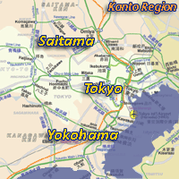
Tokyo, | Japan |
Local
News | Weather
| Haneda
Airport
| Narita Airport |
|
Maps of Tokyo |
|
Click to see full
sized-map
|
|
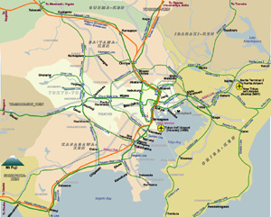
Rail Map of Kanto Region (English and Japanese) |
||
| Date: | July, 2005 | |||
| Map format: | jpeg | |||
| Dimension: | 824 x 661 pixels (279 kb) | |||
| Copyright holder: | Johomaps! | |||
| Conditions of using this map: |
All rights reserved. Contact
|
|||
| Computer Specifics: | Prepared using Adobe Illustrator and Photoshop | |||
|
|
||||
|
|
|
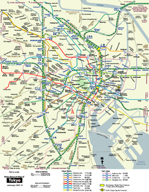
Urban Rail Map of Central Tokyo | ||
| Date: | Nov, 2010 (7th Ed) | |||
| Map format: | jpeg | |||
| Dimension: | 872 x 1124 pixels (631 kb) | |||
| Copyright holder: | Johomaps! | |||
| Conditions of using this map: |
All rights reserved.
Contact |
|||
| Computer Specifics: | Prepared using Adobe Illustrator and Photoshop | |||
|
|
||||
|
|
|
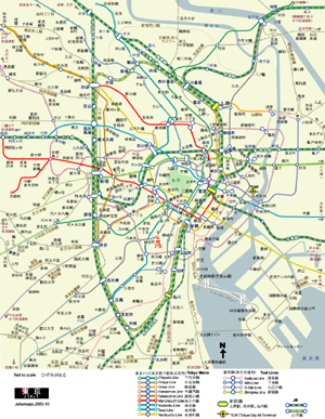
Urban Rail Map of Central Tokyo (Japanese) | ||
| Date: | Nov, 2010 (3rd Ed) | |||
| Map format: | jpeg | |||
| Dimension: | 872 x 1124 pixels (631 kb) | |||
| Copyright holder: | Johomaps! | |||
| Conditions of using this map: |
All rights reserved.
Contact |
|||
| Computer Specifics: | Prepared using Adobe Illustrator and Photoshop | |||
|
Real Time Tokyo Travel Info |
|||||
|
Weather Now |
|||||


