|
|
|
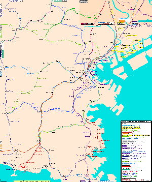
Yokohama Subway Map | ||
| Map format: | gif | |||
| Dimension: | 1290 x 1541 pixels (91.2 kb) | |||
| Copyright holder: | CityRailTransit | |||
| Conditions of using this map: |
All rights reserved. Contact
|
|||
|
||||
|
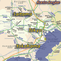
Yokohama, Japan |
Local
News |
Weather
| Haneda
Airport |
|
Maps of Yokohama, Kanagawa-Ken, Japan |
|
|
|
Yokohama Subway Map | ||
| Map format: | gif | |||
| Dimension: | 1290 x 1541 pixels (91.2 kb) | |||
| Copyright holder: | CityRailTransit | |||
| Conditions of using this map: |
All rights reserved. Contact
|
|||
|
|
||||
|
Real Time Yokohama Travel Info |
|||
|
|
|||
|
City Info |
|
Yokohama (From Wikipedia)
Yokohama (横浜市, Yokohama-shi) is the capital city of Kanagawa Prefecture and the second largest city in Japan by population after Tokyo. It lies on Tokyo Bay, south of Tokyo, in the Kantō region of the main island of Honshū. It is a major commercial hub of the Greater Tokyo Area. |
![]()
![]()